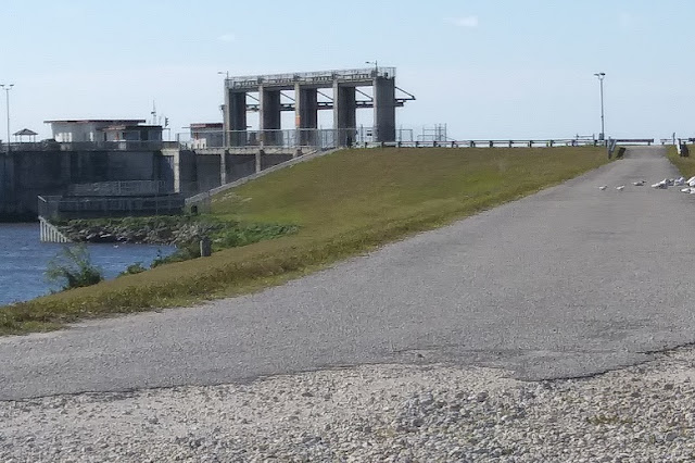
We are in the midst of what the media calls the coldest temps in four years. 50 degrees daytime, and 35 tonight, plus the wind is blowing 20-25 mph. Looking for ideas to keep busy, I suggested a short land trip out to the Port Mayaca lock to see Lake Okeechobee. It is about 20 miles out there, following the Okeechobee Waterway, through lots of low flatlands, and past many ranches and farms. We saw cattle and sod farms, a bamboo nursery, and the whole lake area is known for its sugarcane fields. Besides the sugarcane plants blowing in the wind, we also saw truck after truck of the harvested product being transported.
We arrived at the lock and traveled up the narrow drive to the top of the levy for a view. This part of the road becomes a bike path that I believe goes around the lake (there is another path on the other side of the lock going the other way).
The wind was howling, and we could barely get out of the car to take photos. We quickly took some shots and laughed at ourselves as we ran back to the warmth of the car sitting in the sun.
We did get to see a pair of white pelicans hiding out of the wind in the protection of the levy.
Entering the lock today would be challenging for boaters, with the whitecaps and waves reflecting off the dam.
We have been through this lock many times, and the rise and fall of the water is only about 6" to two feet, depending on the level of the lake. One time the conditions were like this with the waves breaking over the bow of our Bayliner power boat. Going west, it is always an amazing view when they open up the lock doors and you look out onto the huge lake, and you can't see the other side. On our first trip across in our Rhodes 22 ft. sailboat, we spent the night in the pond on the south side of the lock, listening and seeing the orange eyes of alligators swimming around us all night. Dave insisted on sleeping with our boathook at the ready next to the bed, in case one tried to climb aboard. What an introduction to cruising! 😂
Heading east from the lake, the waterway is narrow and the old (probably built in the early 1900s) lift railroad bridge (past the new bridge) is what determines what height sailboat masts can traverse the waterway. Sometimes, boaters make the boat heel over to be able to get under the bridge.
It was a great nostalgic trip, but at this point in our lives, we were glad to have done it by car. By boat it would have taken a couple of days for this section, but by car we left at 9 AM and were home for lunch!
😎


No comments:
Post a Comment